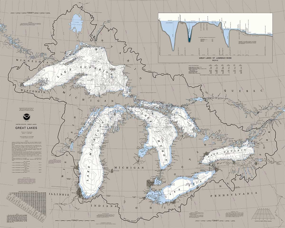
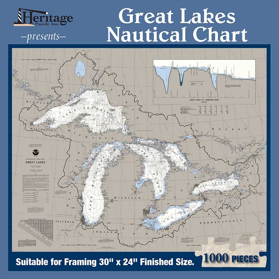


Dive into the stunning beauty of the Great Lakes with the Great Lakes Nautical Chart puzzle by Heritage Puzzles. This 1000-piece jigsaw puzzle is perfect for puzzle enthusiasts aged 11 and above. The puzzle features a detailed nautical chart showcasing the intricate coastlines and waterways of the Great Lakes region. With a height and width of 24" and 30" respectively, this puzzle offers a large canvas to piece together. Immerse yourself in the world of maps and geography as you assemble this captivating puzzle. Whether you're a seasoned puzzler or a beginner, this Great Lakes Nautical Chart puzzle is sure to provide hours of exciting entertainment.

Themes: Maps & Geography
| Age | 11+ |
| Mfg. Part Number | 20701 |
| UPC Number | 654497207017 |
| Item Type | Jigsaw Puzzle |
| Puzzle Category | Nautical & Coastlines |
| Item Number | 133388 |
| Availability | Online Only |
| Warehouse Locations |
Dive into the stunning beauty of the Great Lakes with the Great Lakes Nautical Chart puzzle by Heritage Puzzles. This 1000-piece jigsaw puzzle is perfect for puzzle enthusiasts aged 11 and above. The puzzle features a detailed nautical chart showcasing the intricate coastlines and waterways of the Great Lakes region. With a height and width of 24" and 30" respectively, this puzzle offers a large canvas to piece together. Immerse yourself in the world of maps and geography as you assemble this captivating puzzle. Whether you're a seasoned puzzler or a beginner, this Great Lakes Nautical Chart puzzle is sure to provide hours of exciting entertainment.
Sorry I can t give a review on the quality of the product as it was bought for a Christmas gift. But the pricing and delivery was very good!

For any one who has spent time boating in the region you are sure to enjoy this.
Copyright © 2008-2026, Puzzle Warehouse, All rights reserved.
Puzzle Warehouse recycles everything it can to save the environment and to keep costs and prices low.
We are hiring! Please fill out the employment form or send your resume to careers@puzzlewarehouse.com.


